"How High is Space?" is designed for use in middle grades, but can be used for high school students or informal education as well. Students create a scale model with each piece of 8 1/2" x 11" paper representing 100 km of the atmosphere, and a total of eight sheets of paper.
Activity: How High is Space?
Teacher Guide
Student instructions
Layers of atmosphere information
Atmosphere Information Sheet
Model pictures
After years of using this activity with teachers and students, we recommend using the activity the following way, just as we do in our educator workshops:
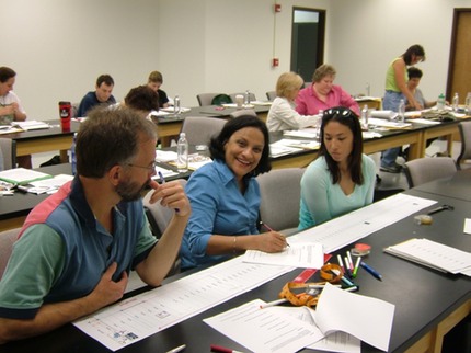
Materials needed per small group of students: scissors, transparent tape or glue sticks, markers (optional), handouts from this activity (single-sided for the scale model atmosphere and picture pages).
- Give each small group of two to three students the eight model pages to assemble with either tape or glue sticks, along with the sheet of model pictures.
- Have the students assemble the eight pieces of paper into one long sheet, with either tape or glue sticks.
- Ask the students to cut out the model pictures and make predictions, as a group, on where they think airplane, mountain top, clouds, International Space Station, etc., could be found in the model. The three images of C/NOFs, the spacecraft carrying CINDI, for lowest, average, and highest altitudes can be used to discuss satellites with elliptical orbits. (Note: orbits tend to be ellipses, but many orbits, like that of the Earth around the Sun are almost perfect circles.)
- Ask the students to cut out and physically lay the pictures down on their model but NOT to tape or glue down their pictures.
- Hand out the Layers of the Atmosphere Information sheet for the students to work with, and at least Part 1 of the "How High is Space?" student table. (Part 2 involves an investigation for students, and the teacher may wish to create higher order questions than provided. Part 2 of this activity is undergoing revision.)
- Have students compare their predictions with the altitudes given in Table 1, move the pictures to their appropriate locations, and tape or glue them down to their scale model.
- Add layers of the atmosphere, information on density, temperature, etc., as desired.

Scale Model Atmosphere Sheets
In the next activity, "Where Would CINDI Be?" deals with Scale in the Earth-Moon System. The activity is designed to tie into this one, but each can be used independently.
